El Guayacán
El Guayacán- Darién, Panamá
Location:
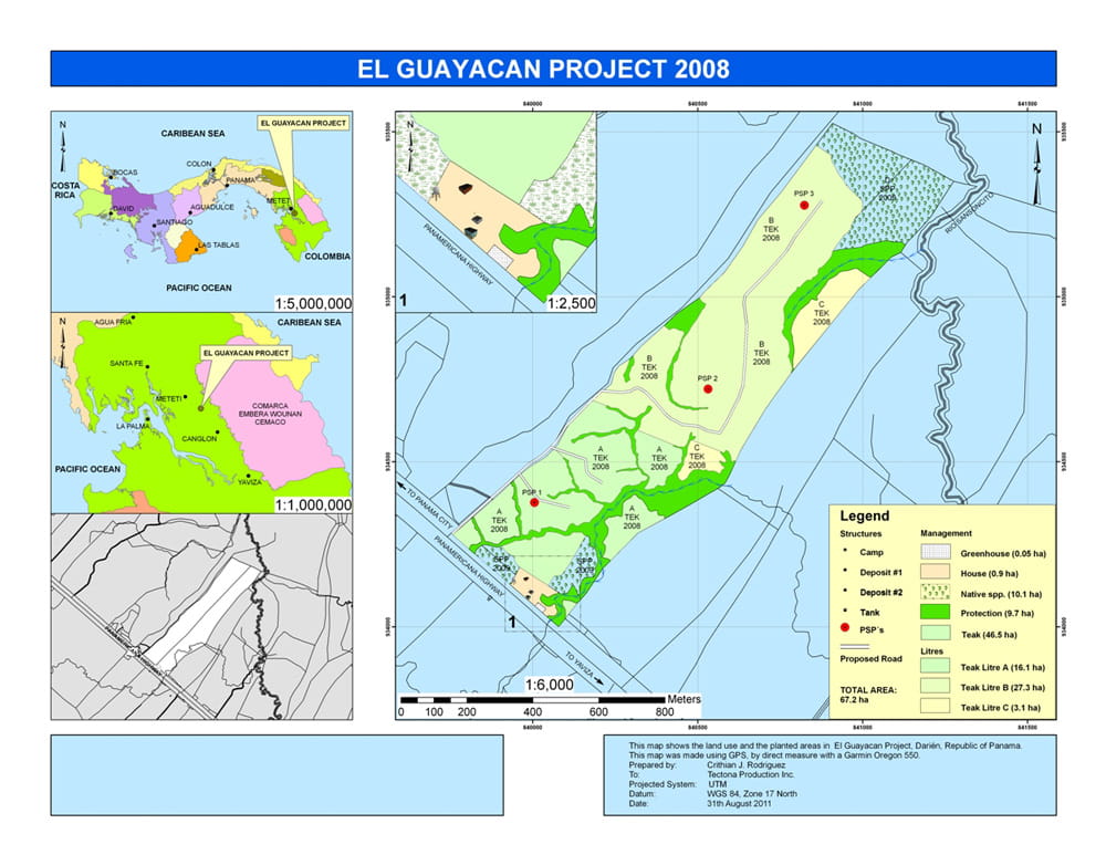
This property is located in Darien province, which is the southeasternmost province of Panama, bordering Colombia.
The property borders the Pan-American highway for approximately 450 meters.
Infrastructure:
Access to the property is optimal, as this property has a 450-meter boundary line with the Pan-American highway, which is paved on this stretch.
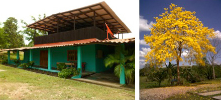
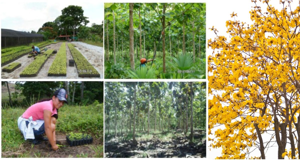
In addition to the property serving as the company’s domicile, Tectona Production also has its nursery at this address, which is capable of producing the number of cover root plants used annually in the project.
Water and electricity:
Due to the property’s optimal location by the main road, there is a connection to the public water and electricity supply.
Address: Carretera Panamericana, km 240, on the way from Panama City to Yaviza in Darién. Republic of Panama.
Gross area: 67.20 ha
GPS coordinates: N 08 ° 43.82 ‘W 77 ° 91.27’
Height above sea level: 64 meters.

The property is named after the tree species El Guayacán (Tabebuia guayacan) which stands on the property.
Documentation of the property's suitability for teak cultivation
- The average temperature in the range is 27°C, which is close to the optimum temperature, which is 25°C to 28°C.
- Annual rainfall is 2500 mm, which falls in the period between the months of April to December, stopping between January and March when it is the dry season, which ensures that the teak trees have deciduous growth and stop growing, resulting in good quality.
- The height above sea level of 64 meters ensures less fluctuations between day and night temperatures. At this height, temperatures are usually more uniform, which is ideal for the growth of teak trees, as growth is favourable in warm and humid climates.
- The soil is a nutrient-rich sandy loam soil with a pH between 6.5 and 6.7, porous, well-drained and deep, ensuring a good supply of nutrients and water with good root development as a result.
- The terrain style is hilly, with varying degrees of slope between 5 and 20%, ensuring that areas are well drained and not under water, even during occasional extreme rainfall.
- Wind conditions are limited to short duration gusts in conjunction with heavy rainfall, which was challenging for the teak trees in the second and third growing seasons due to strong height growth and lack of trunk strength.
- The growing conditions for teak at El Guayacán are classified as High Class Site, meaning quality 1. With optimal operation and the use of genetics, the best possible growth for teak trees can be achieved.
- Growth measurements after the fourth season show that diameter and height are at or above what is expected, compared to international growth tables recognized for optimal teak location.
- We have an updated forest map with description of associated vegetation.
- The Operational Plan was prepared for the plantation operation.
- Annual increment measurements have been taken from the second year of establishment, which facilitates the estimation of the mass of standing wood.

Nursery/pedigree. Planting in September of 2008. /Planting in February of 2012.
Planted area:
The property was planted in 2008
- Teak in a total of 46.50 ha.
- Natural native tree species in mixed forest: Spanish Cedar (Cedrela ordorata), Red Ceiba (Bombacopsis guinata), Rosewood (Dalbergia retusa) and Honduran Mahogany (Swietenia macrophylla). A total of 9,500 m².
- Nature conservation areas cover a total of 9.70 ha.
- Buildings and nursery cover a total of 0.95 ha.
Glory values:
To the northeast, the property borders pristine natural forest adjacent to Panama’s largest reserve for the Native American population, Comarca Embera Wounan Cemaco.
Tectona Production, Inc. has decided to conserve and manage as conservation areas those sites that were not characterized as suitable for teak cultivation. These same areas currently function as corridors for fauna and reservoirs for flora, where birds, mammals and amphibians thrive and which also function as water reservoirs for the tributaries that feed streams and rivers in the surrounding communities.
Map

